I was asked recently by a colleague for some information about the names and locations of local authorities in this country. I was able to respond quickly and usefully thanks to the places database, which sits on the website of the Department for Communities and Local Government.
Here’s what I did, as a simple example of what you can do with this resource. We’re just going to produce a spreadsheet containing the names and contact information for local councils in England. I’m no expert on this stuff, but hopefully this demonstrates some of what is possible, and encourages folk to have a play.
First, go to http://www.places.communities.gov.uk/ in your web browser.
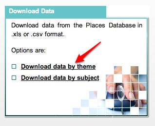
Scroll down and choose ‘download data by theme’:

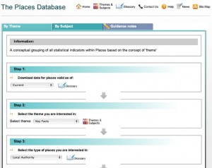
On the next screen, we need to tell the system what information we want to extract through a number of steps. Here’s what steps 1-3 should look like for our example (click for a bigger version):
For step 1 select Current, step 2 select Key Facts, step 3 select Local Authority.
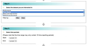
Two more questions to answer:
Step 4 choose Place Details, Step 5 leave start and end dates both as current.
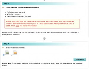
Finally, there is a bit of a warning message – which I just ignore – and then the option to download the data as either an Excel spreadsheet or in CSV format:
Then just hit download, and your data will be saved to your computer. Dead easy.
Thanks to Martin Stone who first pointed this out to me.
I’d be interested to find out what uses other people have been putting this tool to.


We’ve used the Places Survey on our mashup platform http://picandmix.org.uk/categories/community-all/ Is this the same?
Hi Noel, pretty sure it’s the same.